Urbanization today divides each island into static districts that break the technologic capacity of ahupua'a to generate wealth and feed life.
TECHNICS, LOST
 Hawaiian Islands divided into land-use districts.
Environmental degradation of the Hawaiian Islands today reveals the unhealthy outcomes of a model for urbanization designed for continents, not volcanic islands. Hawai'i is the first US State government to have implemented the state-wide zoning of all land into single-use land-use districts in 1961. Whereas the ahupua'a system of urbanism is designed to accommodate special sites and the movement of resources (like rain, wind, and soil) over time, the current Western model attempts to constrict the island in ways that sever the movement of resources necessary for life to thrive.
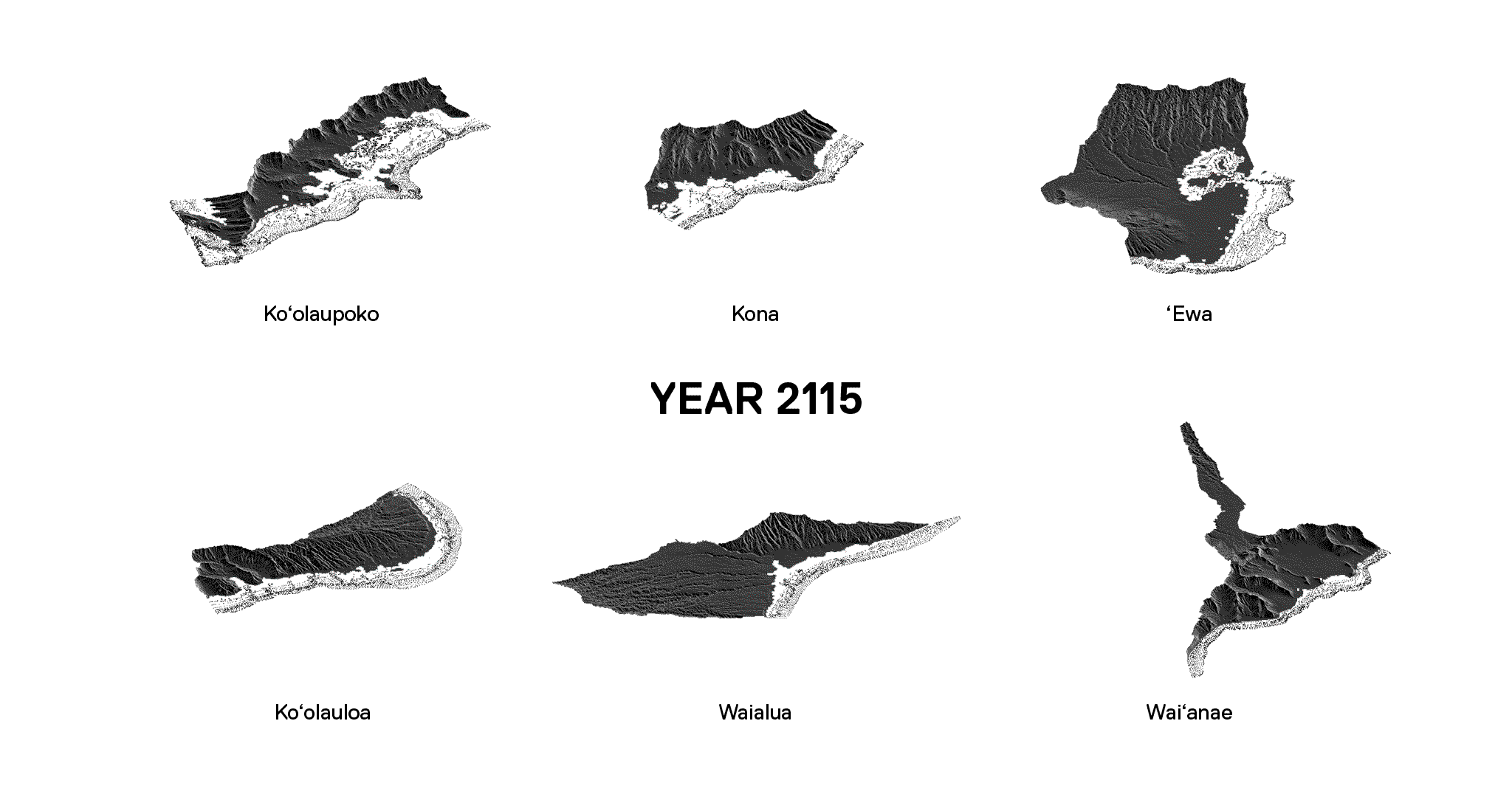
O'ahu, as the most populated and urbanized island, provides a case study of how continental urbanism is detrimental to the health of world ecosystems. A few of the negative consequences of a land-strategy less than 100 years old are described in the maps of O'ahu, below.
 O'ahu Island shown as a living ecology (left) versus a static division of continent-based urbanism (right).
A BROKE LAND-USE MODEL
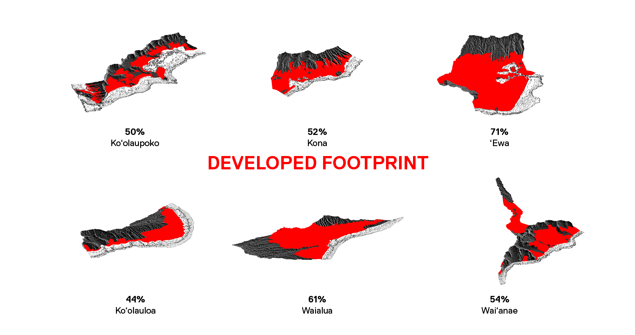
O'ahu land-use districts and the resulting developed footprint.
FRAGMENTED STATE STRUCTURE
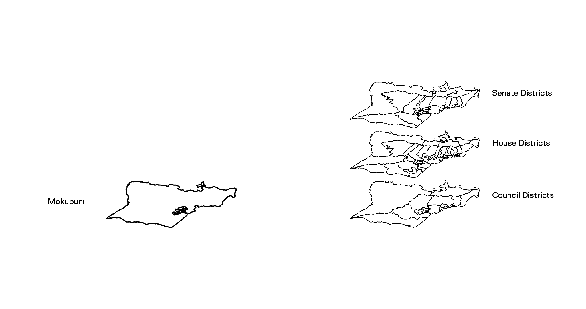
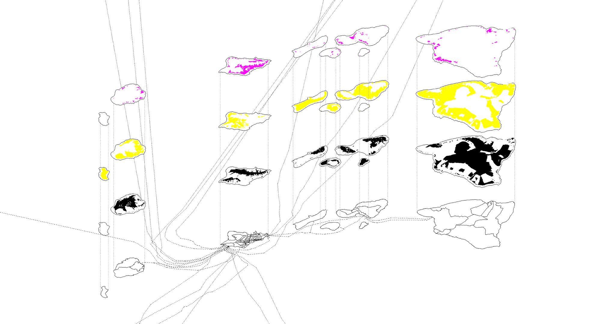
The political districts of the ahupua'a system (left) maintains a strong correlation with the overarching order of ocean-basin watersheds. While geological and genealogical variations do occur across each individual ahupua'a, the consideration of watersheds is most clear at the regional scale of moku districts. The sophisticated, nested organization of political districts across the levels of mokupuni (island), moku (ocean-basin watershed), ahupua'a (unit), and 'ili (surface) reveals a form of island urbanism based in a conception of the cycles and surfaces of water (soil, and sacred sites) as the source of place and value. In contrast to the advanced organization of this Hawaiian system, the Western model is messy and confused, making it difficult to manage and protect precious resources. Today, each island is divided across city and state bureaucracies that do not consistently fit together. The division of land-use districts like urban, agriculture, and conservation furthers the fragmentation of island ecology.
BROKEN STREAMS
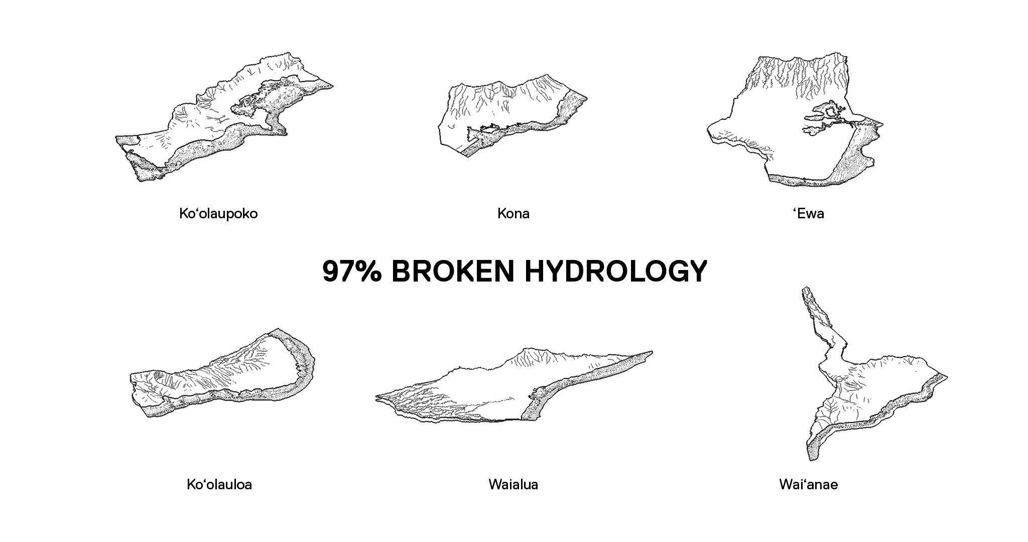
Only mountain and marine areas are typically classified as conservation districts. The division of streams into urban and agricultural districts impairs the ability for watersheds to operate at full capacity. The development of streams limits the ability for watersheds to attract, absorb, filter, and distribute freshwater as it flows from the ocean to the mountain and back again. Urban and agricultural activity leaves streams prone to runoff containing harmful effluents, like chemicals, toxins, and other pollutants, which damage wetlands, reefs, and marine habitats. Where channelization occurs, streams either become unable to support aquatic life during dry seasons, or intensify the surge of floods during storms. The ownership of land along riparian and coastal areas blocks public access, decreasing the value of the stream as a cultural, educational, and recreational resources.
SEPARATION OF FOOD AND SHELTER
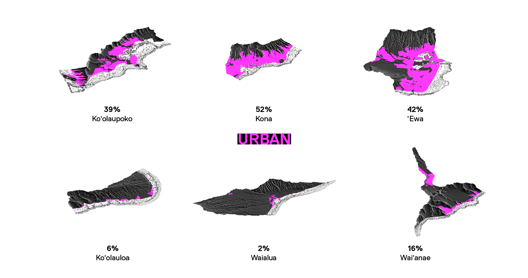
Single-use urban and agriculture districts force physical separations between dwelling, shelter, and natural resources. This prevents the majority of the population from living near where food can be produced. This separation is based on long and complicated Western ideology of town versus country, which undermines the cultural connections between indigenous peoples and their environs.
LOSS OF FOOD SECURITY
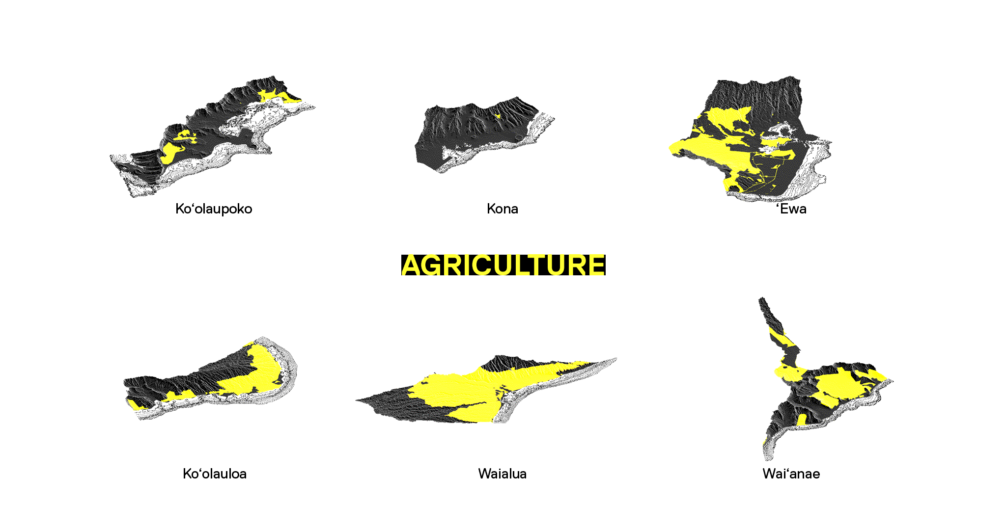
Separation of food and shelter is further impacted by the private ownership O'ahu's land-use districts. In agricultural areas, holding by large landowners expose local food security to the range of interests of landowners seeking to develop agriculture land, produce export commodities over local food stuffs, or engage the district for research and testing that may involve toxic chemicals. Consequently, there is a major inability for the government to safeguard the realms of public health linked to local food-security or environmental health and justice.
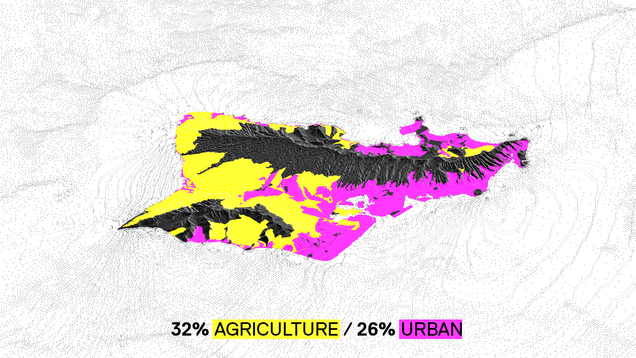
LOSS OF FERTILE SOIL
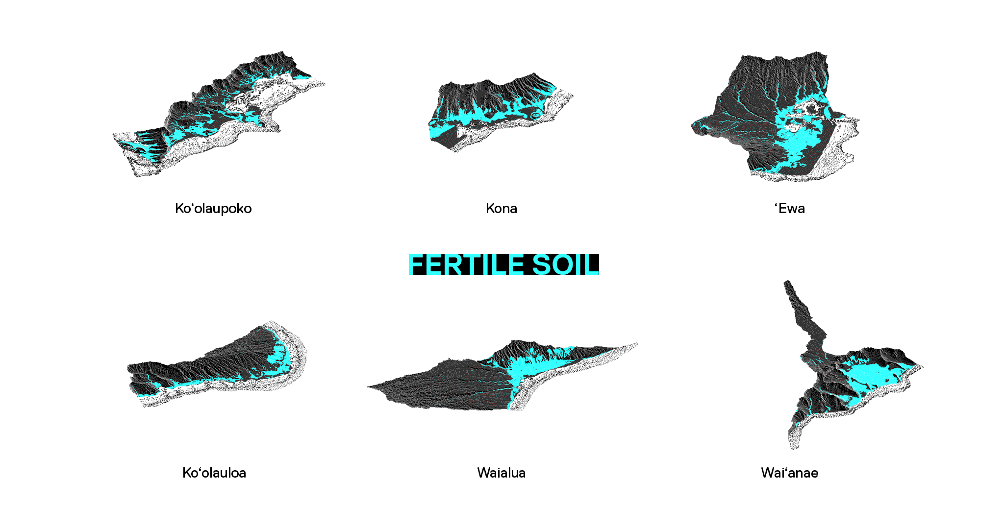
Food security is further impacted by the zoning of fertile soil for urban uses. While many soil types may be cultivated, only about 20% of O'ahu's total land area is classified as fertile soil. 50% of this available fertile soil—one of O'ahu's most valuable resources—has been developed as an urban function.
SEA LEVEL RISE AND BEACH EROSION
The current disconnect between the Western model of urbanism and the movement of resources encourages the development of areas prone to storm surges, tsunami, and sea-level rise. The landscaping and preservation of properties along beaches with the planting of alien grasses, trees, and shrubs, or the construction of seawalls disrupts the cycles of sand necessary to mitigate beach erosion.
DEVELOPED METRO/INDUSTRIAL FOOTPRINT