![]() (Optimization Zone) operates at the scale of 'ili (neighborhoods) and kauhale (city blocks) to manage the city's footprint, productive open space, and economic activity organized around food, schools, and regenerative resource networks.
(Optimization Zone) operates at the scale of 'ili (neighborhoods) and kauhale (city blocks) to manage the city's footprint, productive open space, and economic activity organized around food, schools, and regenerative resource networks.
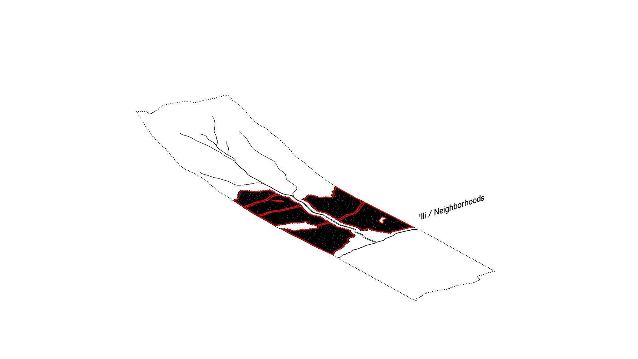
'ILI, NODES, AND NETWORK
![]()
Kauhale at the scale of 'ILI creates a network of NEIGHBORHOODS organized around pedestrian access to resources dispersed with respect to markets and schools. These resources may include the following:
Food Hubs and Farmers Markets:
Kauhale includes local farming initiatives and cooperatives that require citizen participation in the production, processing, distribution, and administration of food resources. These are supported by policies that facilitate a robust 'āina-based food economy.
Regenerative Resource Infrastructure:
Kauhale systems create both closed and open loops of regenerative infrastructures that produce and distribute clean energy, freshwater, grey-water, waste, and food.
Schools and Museums
Special curricula around food production, distribution, and workforce development instill within the people living in each kauhale, an appreciation for the foods they eat and the skills necessary to participate in the local economy.
Local Artists Collectives, Businesses, and Services
Kauhale produce vibrant networks of local arts and businesses collaborating toward self-reliance. Additional services that kauhale support include: banks; places of worship; grocery stores; day cares; cleaners; fire stations; salons; hardware stores; laundromats; libraries; doctors and dentists; senior care facilities; parks; pharmacies; post offices; restaurants; schools; museums; commercial offices; pavilions for performances.
Public and Alternative Transportation
A cohesive and comprehensive network of light rail, bus routes, bike lines, pedestrian walkways maximizes the connectivity and mobility within kauhale. However, it is worth a note that kauhale are built around notions of peopleplace/performance-oriented development, versus transit-oriented development (T.O.D.). Whereas T.O.D. focuses around access to transit nodes, Kauhale focuses around access to food and community resources, at a finer scale to ensure maximum coverage. With kauhale, as an advanced version of T.O.D., access to transportation options become a guaranteed benefit, rather than just a single focus. Drawing a parallel between the idea of neighborhoods as 'ili reinforces the kauhale system as a source of sustenance.
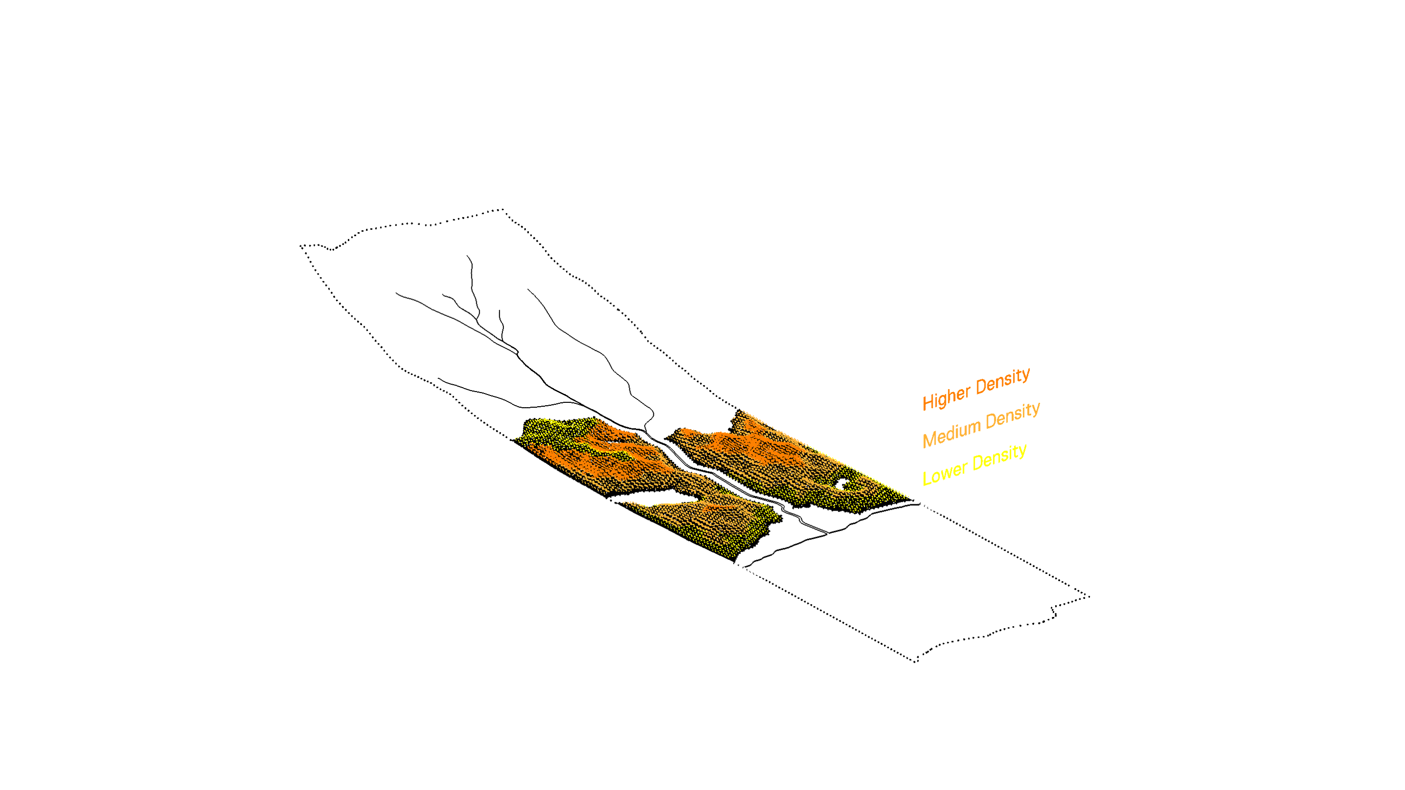
INFORMATION RESOURCE-POTENTIAL ZONES
![]()
Kauhale are managed at the municipal level according to ENVIRONMENTAL INFORMATION AND RESOURCE POTENTIAL ZONES. This describes the evolution of single-use "Euclidian" zoning, into a concept of performance-oriented zoning parameters, which integrate data from the environment into the formation of actual zoning ordinances. For example, with reference to climate, buildings near the shore may generate more energy, while a building in the valley that may harvest more rainwater. With reference to geology, the building typology and functional use of properties may be influenced by the soil types upon which they are constructed; for instance--the difference between a building grown in a region that is meant to be a rainforest versus a building that is grown in a region meant for food production will have different tectonic outcomes. Environmental Information and Resource Potential Zones intensify the resource potential of a kauhale system. This dynamic parallels the traditional trade of kalo and fish between ma uka farmers and ma kai fishermen.
ECOLOGICAL ADJACENCY
![]()
![]()
ECOLOGICAL ADJACENCIES determine population density and building heights according to walking distances to streams, shorelines, forests, wetlands, fields, and other important parameters that define the kīpuka district. These adjacencies reestablish the island's ecosystems as the primary organizing element of the form of the kauhale as city to reinforce the perceptual connection of people to their mauka-makai milleu.
 (Optimization Zone) operates at the scale of 'ili (neighborhoods) and kauhale (city blocks) to manage the city's footprint, productive open space, and economic activity organized around food, schools, and regenerative resource networks.