![]() Describes the fundamental unit of the city, and is the overarching organization of 'āina as the essential system of urbanism.
Describes the fundamental unit of the city, and is the overarching organization of 'āina as the essential system of urbanism.
DATA, MAPPING, AND SPECULATION
![]()
Ahupua'a emerge from data that reveal understandings of how resources may be best utilized. The interpretation of data, and its translation into information that is culturally accessible, is a continual process that occurs in real-time. Data is moving, and changes as it moves through an array of channels, currents, positions—for instance the differences noted in the directions of winds and rains, or sun exposure as islands and trees move. Systems such as land-use districts, which attempt to restrict the general movement data processes to maximize some economic output (like urban, agriculture, or conservation), must be redesigned to keep up with the speed and velocity of the resources (like water and its many translations) in which they attempt to regulate.
![]() Diagram of Ahupua'a at a planetary scale.
Diagram of Ahupua'a at a planetary scale.
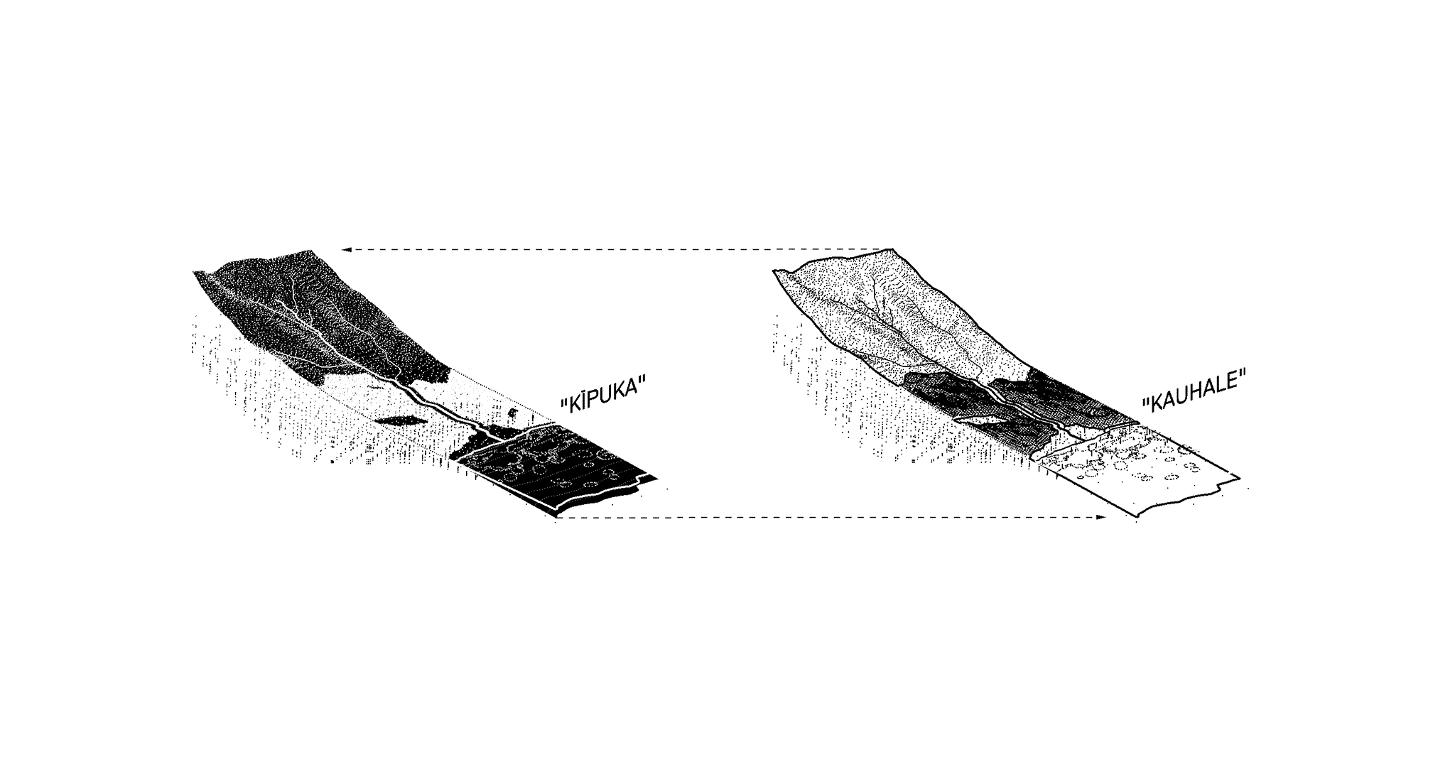
INTERACTIVE LAND-USE
![]()
Kīpuka and kauhale present interactive notions of land-use organization that advance beyond contemporary notions of urban and rural. Interactive land-use categories intensify the link between food and shelter, as a way to intermix and disperse a diversity of functions in a consolidated way. Kīpuka (formerly "conservation") is inclusive of the ahupua'a as a continuous surface, while Kauhale (formerly "urban" and "agriculture"), converge in a way to maximize, rather than disable, ecological cycles of renewal. Interaction between zones occurs across various intensities depending on the relationships between people and their environs, while managing the long-term growth of a developed footprint (kauhale) without hindering watershed health and productivity.
![]()
 Describes the fundamental unit of the city, and is the overarching organization of 'āina as the essential system of urbanism.
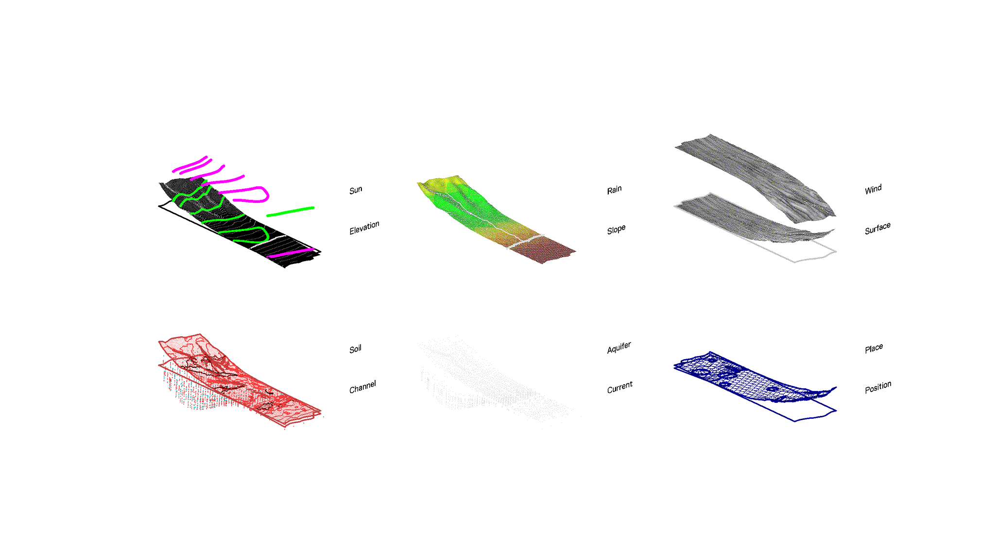
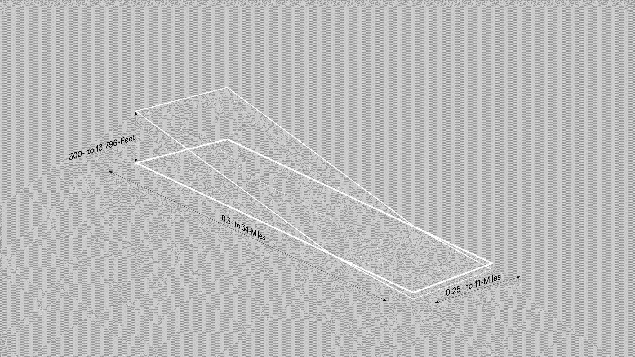 Diagram of Ahupua'a at a planetary scale.